After roughly 32 hours in airports and airplanes, Amanda, my parents and I walked into the warm night air outside Kilimanjaro International Airport. We cleared "customs" and met our driver from Tanzanian tour company Good Earth Tours. This company was great. More about them later.
For the record I think there is an inverse relationship between the low per capita income of a country and the number, size, and intricacy of the required passport stamp. If passport stamps could have epaulettes Tanzania would require them.
Our driver loaded all of our crap into the van. A random guy picked up one of the bags and handed it to our driver. He then turned to me for a tip. Pretty out of it, I turned to my Dad, who gave this guy a dollar. We'd been in the country all of 15 minutes and the expected tipping for "services" and all of the complications that come from that had begun.
As we drove off into the darkness (something Lonely Planet Tanzania strictly forbids), I looked out through a fog of jet lag and excitement and naivete and hoped a lion would cross our path.
After a sketchy shortcut down a rough dirt road and through a random village, we arrived at Planet Lodge, a very upscale if somewhat out of the way cluster of bungalows tourists going to or coming from the airport.
There are tons of different kinds of bananas in Tanzania. Even small ones
The next morning Amanda and my mother headed out to begin their trip to Zanzibar, an island on the Indian Ocean. My brother, my dad and I were on a recommended rest day before beginning our attempt on Kilimanjaro. We decided to go into Arusha, a town of 1.2 Millionish people (Fun fact, less than 16% of Tanzanian births are officially recorded so no one really knows how many people live anywhere. Hakuna Matata).
After a quick self guided tour through Arusha we hired three dudes with motorcycle taxis called boda bodas and headed up a dusty ass road to investigate a waterfall. This was incredibly fun and super dirty. There was so much dust on the "road" that our drivers had to be very careful not to sink into the fine sand pits on both sides of the road. Incidentally no one stops for pedestrians. I often saw cars thoroughly dust down a group of school children waiting to cross the street. We saw a waterfall and a really cool Colobus Monkey and then returned to Planet Lodge in preparation for tomorrow's departure to Kilimanjaro.
Showing posts with label outside. Show all posts
Thursday, December 05, 2013
Planzania
Sometime in 2012, my brother started mentioning that he'd really like to climb Kilimanjaro next year. I murmured the sort of vague assent that I often make when I really want to say yes to something but know I probably won't be able to deliver. "Hmmm sounds really exciting," I said without really committing myself. I spent the next 8 or so months working, wedding planning, and then getting hitched and going on a honeymoon.
A few months ago, Walker said, "I'm seriously going to climb Kili in October. Dad's coming, you should come." Then my Dad started working on me. "I'm not getting any younger," he said. "How many epic trips do you really think I have left in me?" I said I thought he had a lot of time and that I couldn't afford to fly to Africa anyway.
My maternal grandparents are deceased but they were big travelers in their day. My parents once gave them a map of the world and some pins to place in the countries they'd seen. By the time my grandfather died, one couldn't see their map for all the pin heads. In short, my parents invited Amanda and I on a two-week all expenses paid trip to Tanzania! This trip would be a tribute to my mom's parents and their love for travel. The loosely conceived plan: My brother, my father, and I would attempt Kilimanjaro while my mother and Amanda would visit the beaches of Zanzibar. Then we'd all reconvene for a week-long safari through the Serengeti. Amanda and I said yes and my parents promptly purchased non refundable airfare.
Parts of the planning process made me want to kill myself and everyone else involved. It seemed that my mother wanted to see every village in Africa. Meanwhile my wife and I had major concerns about we as tourists recreating harmful colonial experiences, and other issues surrounding ethical travel. I was caught between wanting to avoid taking part in "native" performances put on for rich Mizungus while respecting my parents desire to have the trip of their lifetime. After all, they were paying for it.
In no particular order, the five of us researched tour companies, changed budgets and itineraries, and got drugs for Hep C, Yellow Fever, Typhoid Fever, Malaria, Altitude Sickness, and The Shits. I also loaded up on allergy meds because, as it turns out, I sometimes have really scary allergic reactions that require stabbing an epi pen into my thigh. Walker, the only one who had traveled in sub Saharan Africa before, wisely decided to remove himself from the planning process. Veteran move. At one point I had to take a stand as my mother was insisting on taking public transportation everywhere in Tanzania. (Here's why this is bad). I always worry before doing things I've never done before. I worried that I wouldn't make it up Kili. I worried that my Dad wouldn't make it either. I worried that I'd get sick over there. I even worried that the five of us would create National Lampoon's Safari Vacation or something much more tragic.
Eventually, worried or not, with everything booked it was time to go.
Wednesday, February 23, 2011
No Shortcuts to the Top
I recently finished reading the aforementioned book by Ed Viesturs, the first American to summit all fourteen 8,000 meter peaks. His feat is even more impressive when you consider that he did so without using supplemental oxygen. I would recommend this book to anyone interested in motivation, climbing, and patience. Since I'm very interested in two out of three, this proved to be a great read. What struck me most was the measured and careful way in which Ed climbed. Upon discovering that conditions were simply too dangerous to continue climbing, Ed repeatedly turned around to await a safer opportunity, often doing so less than 400 feet from the summit. Unlike so many climbers who have pushed themselves way too far, allowed themselves to get started late, or failed to put in the hard work training, Ed time and again refuses to make these completely avoidable missteps. Everyone loves a good adventure story and climbers such as Reinhold Messner, Maurice Herzog, and Herman Buhl deliver exactly these but these are climbers who have pushed themselves well beyond any acceptable risk threshold and as a result, it's hard for me to relate. As Viesturs penned frequently in 'No Shortcuts,' "Getting to the top is optional; getting down is mandatory." In my next post I'll be compiling a list of Climbing dos and don'ts but for now, suffice to say that I have a new hero.
Monday, August 09, 2010
Rescue on Blanca Peak/Ellingwood Point
This past weekend, Reid Lustig, Jeremy Lauffenburger, gnightmoon, and I were involved with this rescue, although not to the extent that the writer was. More details coming soon.
There is a fascinating thread here on 14ers.com with the victim, "thruhiker," weighing in around page 4.
Labels:
outside
Sunday, August 01, 2010
Wednesday, July 28, 2010
Lofty Goals
On Friday night, Jeremy, Walker, my dad Jeff, and I went to bed around 10pm. We awoke at 12:50 and drove to Longs Peak Trailhead. At 2am, we hit the trail.
We hiked above the trees and then the clouds, looking for a trail that would take us to the Loft Couloir. We entered the couloir shortly before dawn.
As day broke around us, we made our way up steep slopes lit by Alpenglow.
Although over 200 people would summit Longs Peak today, only about 15 attempted this route.
The couloir exit involved a small amount of exposure but no tricky moves. You can see the trail into the couloir far below.
This hike is incredibly dramatic. It is easily one of my top three favorite climbs.
After reaching the loft, we began traversing along the backside of Longs Peak (behind the Beaver and The Notch). This involved downclimbing a scary section in order to reach Keplinger's Couloir.
There are definitely some class 4 moves on this trip.
After ascending Keplinger's, we joined the final stage of the Keyhole Route (at The Homestretch) and made the final push to the top. This is Walker and Jeff summitting Long's Peak together.
Unbeknownst to us, Walker had packed a nice bottle of champagne and 3lbs of dry ice to celebrate. Best champagne I've ever had!
After our champagne brunch and a nap, we headed down via the Keyhole Route.
15 hours after we'd begun, we reached the cars.
We hiked above the trees and then the clouds, looking for a trail that would take us to the Loft Couloir. We entered the couloir shortly before dawn.
As day broke around us, we made our way up steep slopes lit by Alpenglow.
Although over 200 people would summit Longs Peak today, only about 15 attempted this route.
The couloir exit involved a small amount of exposure but no tricky moves. You can see the trail into the couloir far below.
This hike is incredibly dramatic. It is easily one of my top three favorite climbs.
After reaching the loft, we began traversing along the backside of Longs Peak (behind the Beaver and The Notch). This involved downclimbing a scary section in order to reach Keplinger's Couloir.
There are definitely some class 4 moves on this trip.
After ascending Keplinger's, we joined the final stage of the Keyhole Route (at The Homestretch) and made the final push to the top. This is Walker and Jeff summitting Long's Peak together.
Unbeknownst to us, Walker had packed a nice bottle of champagne and 3lbs of dry ice to celebrate. Best champagne I've ever had!
After our champagne brunch and a nap, we headed down via the Keyhole Route.
15 hours after we'd begun, we reached the cars.
Labels:
outside
South and North Arapaho Peaks
The day after climbing Navajo, I met Tom, Ryan, and Jeremy to attempt the traverse between South and North Arapaho Peaks.
Labels:
outside
Navajo Peak
Sometimes I think it takes me longer to post about peaks than it does to climb them. As always, the photos do the talking.
Walker, my dad, and I set out to climb Navajo Peak, the pointy, beehive-like one to the left of center.
After a quick three mile cruise past two lakes, we arrived at this lake and the vertical part of the climb. As Gerry Roach often says, "the introduction was over."
We climbed up a few snow fields, and across this long boulder strewn basin before entering Airplane Gully, named for a plane that crashed high on the mountain in 1948.
Walker by the part of the wreckage
Nearing the top
Jeff and Walker climbing out of Airplane Gully
Dad atop Navajo peak.
SummitMonster
After a short nap, we headed back down. A nice warmup for the Longs Peak climb in 6 days.
Walker, my dad, and I set out to climb Navajo Peak, the pointy, beehive-like one to the left of center.
After a quick three mile cruise past two lakes, we arrived at this lake and the vertical part of the climb. As Gerry Roach often says, "the introduction was over."
We climbed up a few snow fields, and across this long boulder strewn basin before entering Airplane Gully, named for a plane that crashed high on the mountain in 1948.
Walker by the part of the wreckage
Nearing the top
Jeff and Walker climbing out of Airplane Gully
Dad atop Navajo peak.
SummitMonster
After a short nap, we headed back down. A nice warmup for the Longs Peak climb in 6 days.
Labels:
outside
Monday, July 26, 2010
Saturday, July 10, 2010
Fools on the Hill
To celebrate the Fourth of July, Walker, Jeremy, and I attempted to summit Fools Peak, one of the mountains listed in Dave Coopers (now self-published?) book Colorado Scrambles. We chose Fools for three reasons:
We met up with Brooks and Natalie at a camp site on the Colorado River. Walker fixed a wonderful dutch oven stew. Brooks snagged Jeremy's machete and the best image of the trip. At 5:30 a.m., Jeremy, Walker, and I left the other two snoozing and headed to the trailhead.
The trail begins at Fulford Cave Campground, and proceeds quickly up through 4 easy miles of lush woodland. I decided to tell REI that yes, it's still legal to hike in cotton.
Our first destination was Lake Charles, a wonderful camp spot set below Fools Peak (to Walker's left).
After circling to the far side of the lake, we headed up a grassy, boulder strewn gully to reach the rocky base of Fools Peak.
After reaching treeline, we crossed a small basin and headed up the North ridge of the peak (straight up the middle of the mountain in this photo)
This is what it looked like up close.
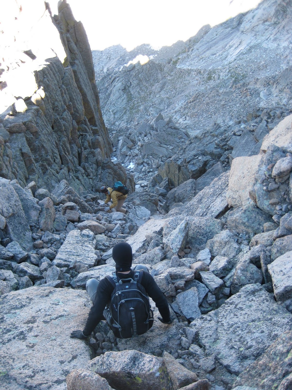
The mountain is actually split by a large gully, which tops out at this steep notch. The route suggested reaching the gully by finding a downward sloping ramp, which can be clearly seen in the middle of this photo, (which I took from a thousand feet away after we'd descended). Up close, however, the ramp proved very difficult to find. We first tried the lower ramp, but balked at the steepness of the gully at the ramp's end. We then retraced our steps all the way to the left and climbed to the top of the spire, only to find ourselves peering off that poky point at the top, a sight that left Walker and I with goosebumps. Finally Jeremy worked his way down and found the correct ramp which soon brought us to the gully.
Although it's not visible in this photo, the suggested route involved climbing directly up 600 vertical feet of rock slicked by melting ice and snow. This seemed like a terrible idea so we angled our way from left to right between these snowfields and then scrambled up 400 feet of scree to gain the soft ridge on the right. From there it was only 20 minutes or so to the top!
Rarely have I encountered such perfect weather on a Colorado climb. After a sparse lunch, the three of us found flat-ish spots and fell asleep.
Too quickly, it was time to head down. During lunch, my IT bands had stiffened, which made for a rather painful descent. I popped some Ibuprofen and at Walker's suggestion, rolled back and forth on top of a waterbottle. Painful but effective.
To save my knees, we slid down some gentile snowfields. On one of these, I accidentally almost peed on Jeremy. I limped down the remaining scree field and the gully, returning to Lake Charles. By the time we reached the lake, my body had warmed up. 2 hours later, we were at the cars. 12 miles in 10 hours. Not too shabby when you factor in that we lost the route, amended the route, and napped at the top. Can't wait for Longs in two weeks!
- "Towering" at not even 13,000', Fools is not well known. We hoped to avoid crowds.
- This peak offers some of the best class 3 scrambling in the state; a perfect warm up for potential assents on Longs and Capital Peaks, The Maroon Bells and/or Ice Mountain
- Brooks and Natalie happened to be camping about ninety minutes from the trailhead.
We met up with Brooks and Natalie at a camp site on the Colorado River. Walker fixed a wonderful dutch oven stew. Brooks snagged Jeremy's machete and the best image of the trip. At 5:30 a.m., Jeremy, Walker, and I left the other two snoozing and headed to the trailhead.
The trail begins at Fulford Cave Campground, and proceeds quickly up through 4 easy miles of lush woodland. I decided to tell REI that yes, it's still legal to hike in cotton.
Our first destination was Lake Charles, a wonderful camp spot set below Fools Peak (to Walker's left).
After circling to the far side of the lake, we headed up a grassy, boulder strewn gully to reach the rocky base of Fools Peak.
After reaching treeline, we crossed a small basin and headed up the North ridge of the peak (straight up the middle of the mountain in this photo)
This is what it looked like up close.
The mountain is actually split by a large gully, which tops out at this steep notch. The route suggested reaching the gully by finding a downward sloping ramp, which can be clearly seen in the middle of this photo, (which I took from a thousand feet away after we'd descended). Up close, however, the ramp proved very difficult to find. We first tried the lower ramp, but balked at the steepness of the gully at the ramp's end. We then retraced our steps all the way to the left and climbed to the top of the spire, only to find ourselves peering off that poky point at the top, a sight that left Walker and I with goosebumps. Finally Jeremy worked his way down and found the correct ramp which soon brought us to the gully.
Although it's not visible in this photo, the suggested route involved climbing directly up 600 vertical feet of rock slicked by melting ice and snow. This seemed like a terrible idea so we angled our way from left to right between these snowfields and then scrambled up 400 feet of scree to gain the soft ridge on the right. From there it was only 20 minutes or so to the top!
Rarely have I encountered such perfect weather on a Colorado climb. After a sparse lunch, the three of us found flat-ish spots and fell asleep.
Too quickly, it was time to head down. During lunch, my IT bands had stiffened, which made for a rather painful descent. I popped some Ibuprofen and at Walker's suggestion, rolled back and forth on top of a waterbottle. Painful but effective.
To save my knees, we slid down some gentile snowfields. On one of these, I accidentally almost peed on Jeremy. I limped down the remaining scree field and the gully, returning to Lake Charles. By the time we reached the lake, my body had warmed up. 2 hours later, we were at the cars. 12 miles in 10 hours. Not too shabby when you factor in that we lost the route, amended the route, and napped at the top. Can't wait for Longs in two weeks!
Labels:
outside
Subscribe to:
Posts (Atom)